
The most beautiful multi-day hike in Lofoten, Norway
In short
-
Duration: 6 days
-
Distance: 66.5 km and 3610 height meters
-
Wildcamping: allowed, 150 m outside of other peoples premises
-
Seasonality: June – September
- Public transport: Å (arrival) and Fredvang kryss (departure)
- Resupply: one supermarket in Sørvågen
- Highlights: Horseidvika beach, Hermannsdaltinden, Munken with a view on Reinebringen.
In August of 2023 I did a multi-day hike through the Lofoten area in northern Norway, an archipelago of one of the oldest mountain ranges in the world. This hike showed us everything this area has to offer: beautiful, steep mountains, huge, natural fresh-water lakes, fjords, the crystal clear ocean, never ending sunsets and abandoned beaches. The hike took us from the outermost tip of Lofoten called Å to Fredvang, while camping along the way.
Planning this hike was a bit harder than expected. Lofoten consists of many islands only connected to each other by one big (car) road. Therefore most hikes in the area are day-hikes.
Norway is one of the only countries where wildcamping is allowed almost everywhere, through a law called ‘allemansrecht’ (all-mans-right). The law states that you can sleep everywhere which is not in the vicinity of 150m of someone’s premises, so free accomodation for all!
The hike
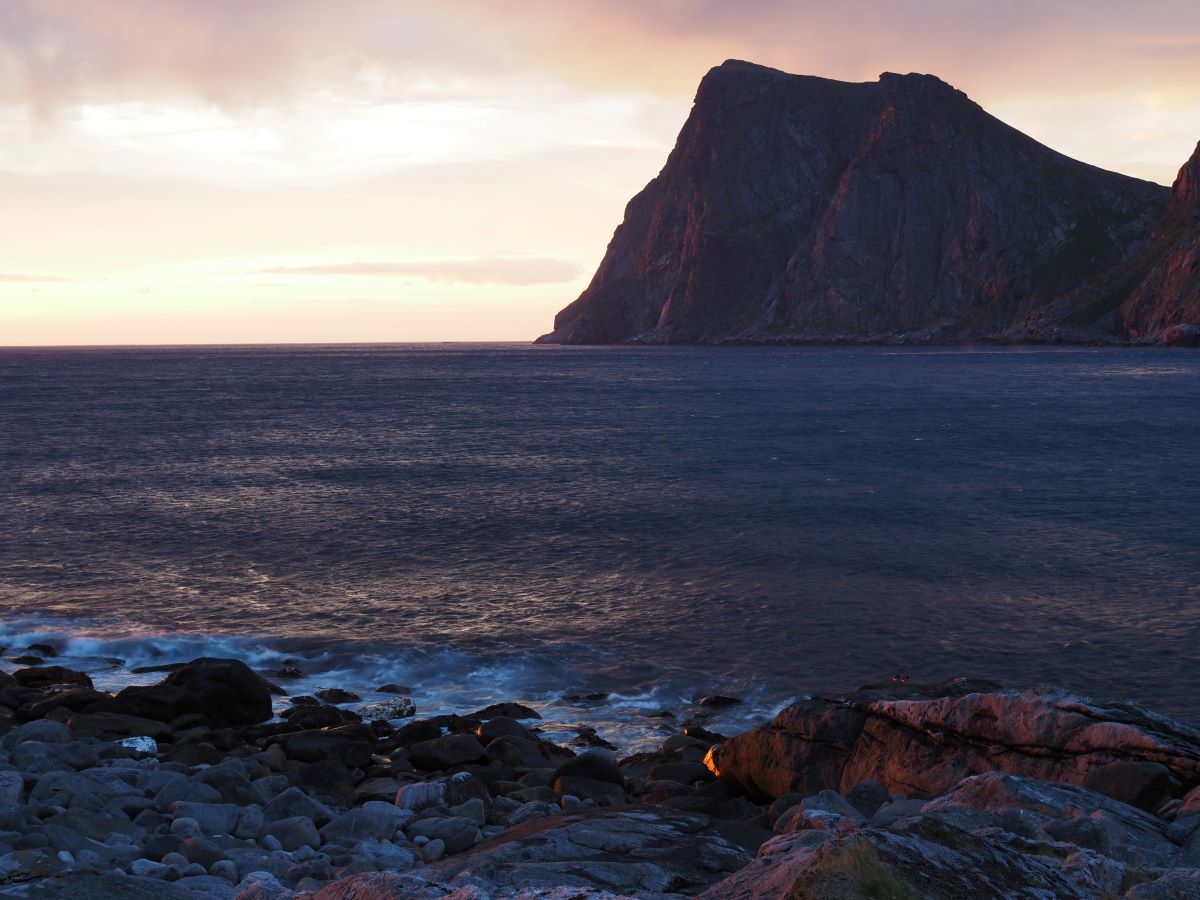
A rainy start in å
The archipelago of the Lofoten area lays quite far out of the coast, and therefore the weather can be a bit more harsh than in other places in Europe. Our hike started with two days of almost constant rain (perfect). Although it was not pouring on us, a constant stream of drizzle and fog also made us pretty tired.
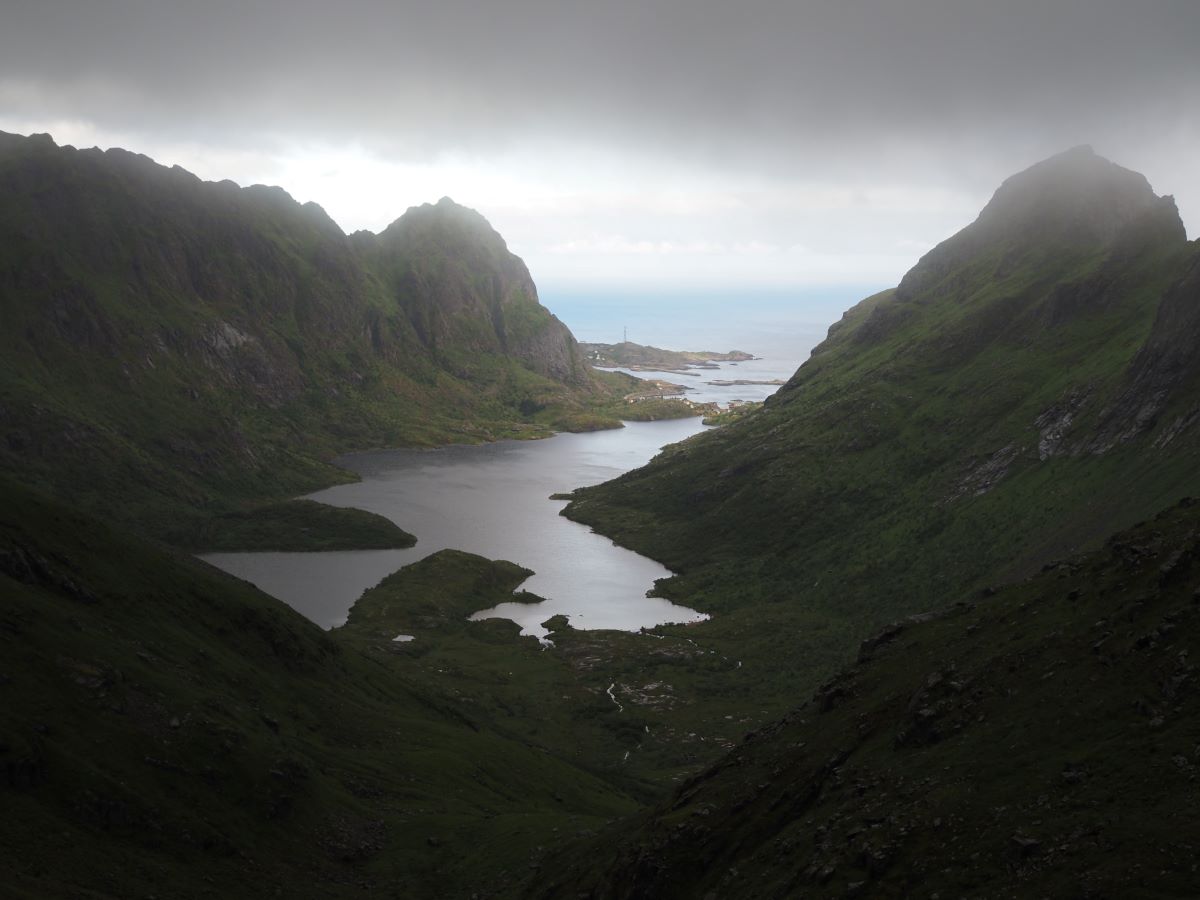
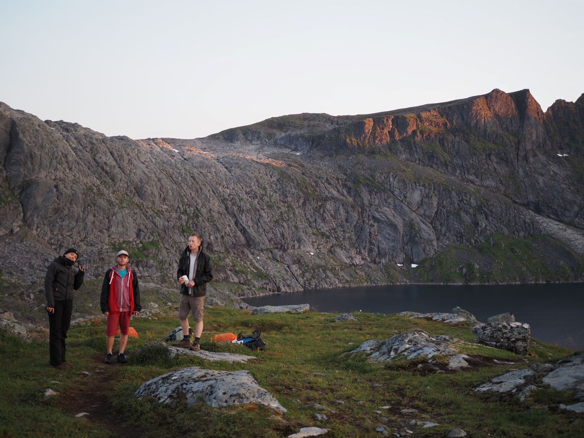
The first part of the planned hike would have taken us from Å all the way to the most south-western tip of Lofoten and back. But, since the weather was so bad, we only made it to the pass just west of the Ågvatnet lake. When the wind is coming from the west, the weather on the western coast of the Lofoten is often much worse than in the East. The clouds get stuck on the west side behind the mountains, and therefore it’s often foggy, windy and rainy at the same time. The path we took up to the pass was also not an official hiking path governed by the Norwegian hiking society. On the road there were many loose rocks, which could easily trigger small rockfalls (yes, pretty dangerous for the people below you). There was one part where you needed to climb a vertical wall of 2 m using an attached rope. All in all nothing extreme, but not made for people who are scared of heights. Once arrived on the pass, it was so windy, rainy and foggy, that we couldn’t even see more than 10 metres ahead (let alone the ocean). We just wanted to get back and be warm and dry again.. so much for hiking :).
indispensible: up to munken and hermannsdaltinden
The morning of the second day the weather was still very changeable (read shitty). Therefore we treated ourselves with a cinnamon bun and chocolate cake from the local bakery in Å (equals happiness). Afterwards we hiked to Sørvågen to the last supermarket of the trip.
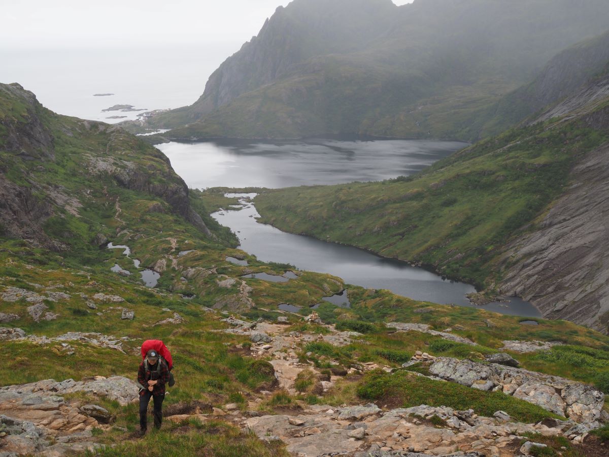
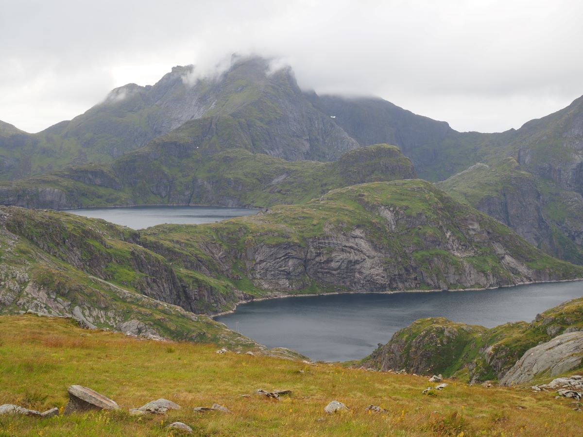
After this lazy morning we started hiking up to Munkebu, which is something you should not miss, while visiting lofoten. Munkebu is a small hut which you can rent and you can pick up the key from Sørvågen (more information can be found here). The area around Munkebu is extremely beautiful, with many natural lakes on different altitudes and a different peaks to climb in half a day. We slept close to the Munkebu cabin, and ascended to Munken the following day. Munken gave a fantastic view on Reinebringen and Reinefjorden. In the afternoon we continued on the route and climbed up Hermannsdalstinden in the evening. Hermannsdaltinden is the highest peak of the area (second highest of Lofoten) and this was my personal favorite part of the trip. Two other peaks close to Munkenbu which can easily be climbed in in half-day hikes are Moldtinden and Støvla.
The ferry to Kjerkfjorden
On the fourth day of our hike we needed to take a ferry, of which we couldn’t find much on the internet. We planned to walk to Vindstad and take the ferry from there to Kjerkfjorden. However we heard from multiple sources that the road to Vindstad was very steep and not pleasant to hike. When we arrived at the harbour in Fjorsfjorden, there was nothing to be found (no phone number or schedule). Luckily we ran into someone who had a picture on their phone (gotten again from somebody else) with a phone number and the timetable of the ferry. In the year of 2023 the ferry would depart twice in the morning (before 12), and twice in the evening (after 6). The route that we wanted to take, going to Kjerkfjorden from Fjorsfjorden, was only availble with an upfront call reservation. We called the ferry and hung out in the harbour for almost four hours, with almost nothing to do and some more than occasional drizzle to keep us nice and cold.
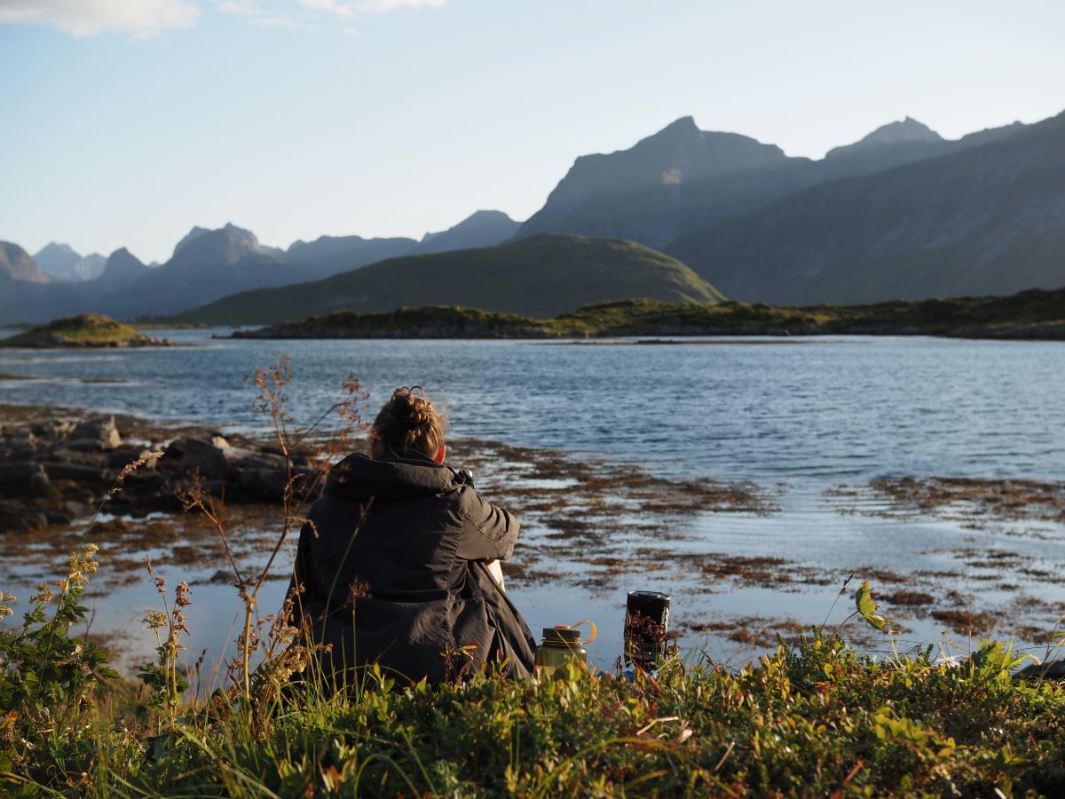
Nordic beach-life
The last two days of the hike in Lofoten were amazing, we had loads of sun, but also heavy wind. Upon arriving in Kjerkfjorden, we walked to to nearby Horseidvika beach. There we slept with an ocean view which we didn’t have to share with anyone.
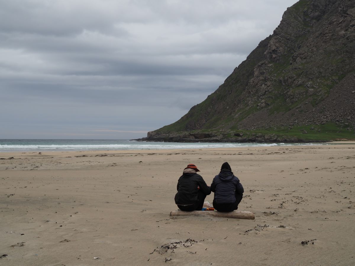
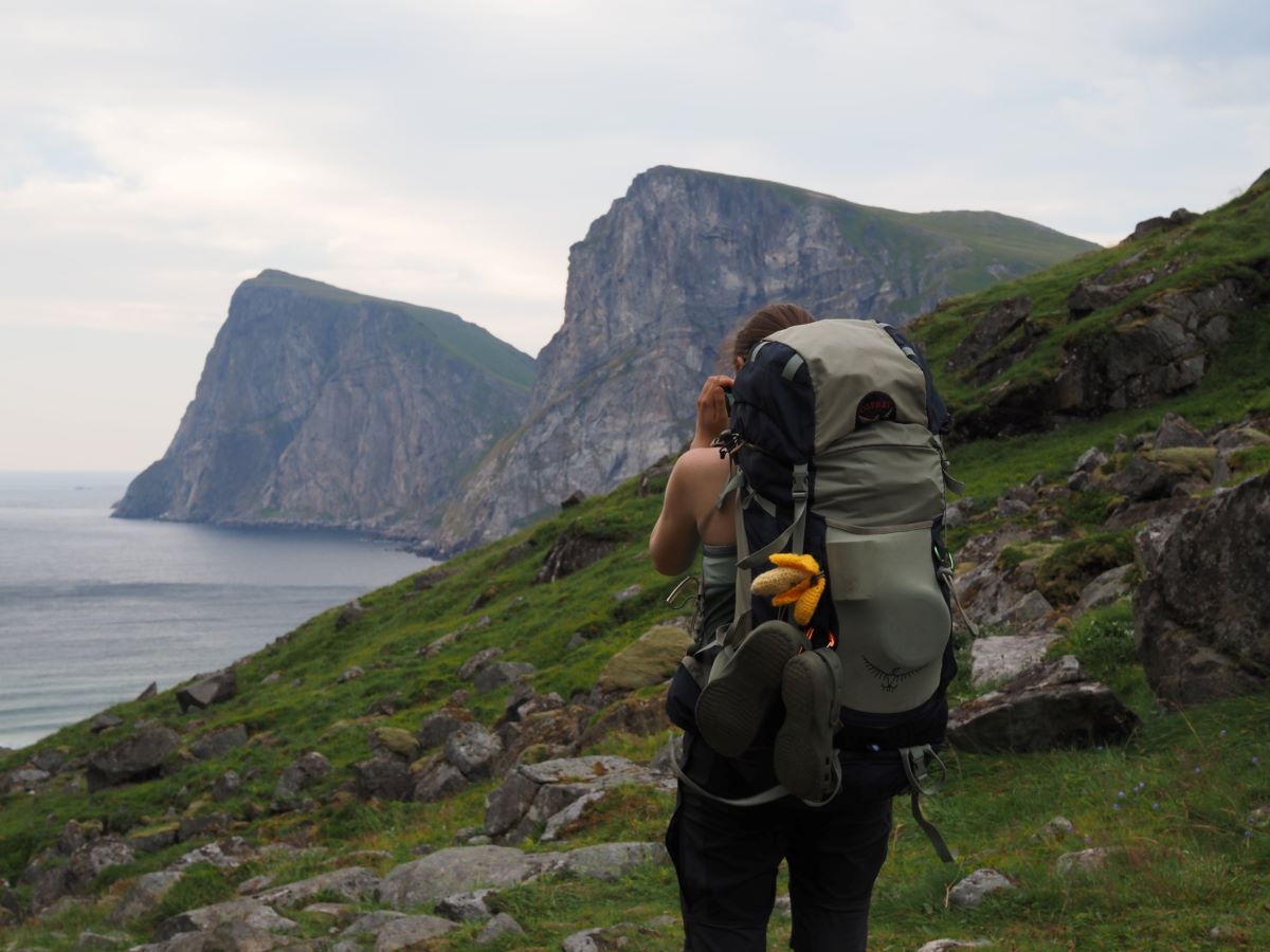
The next day we hiked to Kvalvika beach, with barely seeing any other people on the way. Kvalvika beach actually consists of two beaches separated by an area with large rock boulders. We slept on the southern part of the beach, which was very exposed to wind, but didn’t have many tourists. On the south west side of the beach there was a grassy area which was a bit more wind protected and had a great view on the ocean, Middagstinden and the setting sun. The sunset we saw on this beach was the most perfect one I have ever seen in my life. Due to the midnight sun, it also lasted what seemed like forever. The sun was just a giant orange bulb slowly sinking in the horizon, reflecting pink and purple colours on the water and surrounding mountains. That night we slept without tents, since sleeping bags are surprisingly windproof, and tents can break easily under heavy wind. Because it never got dark, we couldn’t do any stargazing, but we did see seals in the water, and a rabbit on shore.
The last day we scrambled over the rocks that separated the beaches under heavy wind, which made it a bit scary. From the northern beach we took the touristic route back to Fredvang, and passed an amazing foodtruck which served exactly what we were craving for (fries!!). We slept next to the water close to the main Lofoten road (E11), again without tents, since the weather was so amazing. At this point only two of the group was left (everyone else had left earlier) and the next morning we both went our separate ways.
The route
How to get there
Getting to the start of the hike of Lofoten is not that easy, but there are a few options. There’s a night train from Stockholm to Narvik, which can be purchased through VY.se. A nighttrain from Hamburg to Stockholm, run through SJ, also runs daily, but should be booked well in advance. When you have arrived in Narvik, there’s a bus going to Å with one transfer in Leknes, the total drive takes approximately five hours. This bus only goes twice a day, but the buses wait for each other on the islands, so don’t be scared about missing your transfer.
Another option is the night or day train from Trondheim to Bodø (can be booked here), and from there take the four hour ferry to Moskenes. The ferry is free for passengers on foot and Moskenes lays 5 km north of Å.
The route ends right next to the main bus line, at the busstop Fredvang Kryss. Here busses go regurlary into the direction of Å/Moskenes (if you want to take the ferry) or Svolvær/Narvik (for trains).
Good to know
Wildcamping – As said before wild camping in Norway is almost everywhere allowed except for in the range of 150m of someone’s premises, or in some national parks and fresh water reservoir areas.
Resupply – On the route there’s only one resupply point in Sørvågen. In 2023 there was a foodtruck at the end of the route, at road just after Fredvang. The foodtruck was called ‘by the way Lofoten’ and served homemade falafel, fries and freshly catched fish. I don’t think it is necessary to say that we indulged ourselves.
Water supply – There are plenty of fresh water lakes and streams around Lofoten. I always drank the water from everywhere, without getting sick (still on your own risk though). When camping next to water, you don’t need to bring more than one liter while hiking.
Road quality – Most hiking paths are well maintained, but there are parts (especially in the up- and downhills) where the path consists of large rocks to hike on. Also since there’s so much water around, roads can often be muddy and slippery, especially after it had rained. When going over a pass or on a peak, often the path was very steep.
Apps & websites – Some usefull apps and websites for hiking in norway:
- NorgesKart app for topographic norwegian maps and hiking routes.
- VY: the norwegian train company.
- YR: Norwegian weather app.
Best time to hike & weather
We did this hike in high summer (beginning of August) and the weather was still quite rough, from lots of rain to strong wind and gusts. The wind mostly comes from the ocean/south-west and the weather is often harsher on the western side of the islands as compared to the eastern, because it gets stuck behind the mountains. Even when it’s sunny, the winds can be very strong and it can therefore be quite cold. One of the most important things I learned during my time in lofoten was that the weather can be extremely changeable, you can basically get sun-burned, get cold from the rain and be blown away from the tracks on the same day. Check YR for a more accurate weather report.
Geology
One of the coolest thing about Lofoten is that it is one of the oldest mountain ranges in the world and has some of the wolrd’s oldest rocks (around 1800 Ma). The rocks have a volcanic origin, but have been transformed a bit over time. The main rock types you can find are granite and syenite, which both have a magmatic origin. The difference between magma and lava is that you call it magma under the earth’s surface and lava above.
Several ice ages made the current alpine landscapes of the Lofoten. It is thought that the peaks in Lofoten were created by glaciers that were smaller than the rest of scandinavia, and that Lofoten acted as a wall that guided the ice south. Out on the shelf, the ice masses were thin enough for the peaks to stick out of the ice. Therefore glaciers – more than the massive ice masses – contributed to grinding the mountain peaks from both sides over several periods. The carving by ice is the reason that there are not many mountain plateaus found in the area.
In some areas you can see evidence of glacial striation, scratches or gouges cut into the bedrock as a result of rocks and sand transported by the moving ice sheet. Around Reine you may find dark gray stripes, which are the marks of earthquakes that happened up to 400 million years ago.
The differences in rock formations in Lofoten are due to the age of the rock. At the far end of Lofoten, as in Lofotodden National Park, the peaks are wilder and sharper because they consist of harder rock types that originate from the earth’s primeval times. Hard rock such as granite grinds down more slowly, thus the dramatic appearance. Further into Lofoten, towards Leknes, there are younger and less hard rock. The consequence is a softer appearance of the surrounding mountains.

")


mei 31, 2025 @ 23:43
Incredible tons of helpful information!