
Zermatt: three days hiking around the Matterhorn in Switzerland
In short
-
Duration: 3 days
-
Distance: 37 km and 2400 height meters
-
Wildcamping: tolerated above the tree line
-
Seasonality: July – September
-
Public transport: Zermatt (arrival and departure)
-
Highlights: Matterhorn basecamp (Hörnlihütte, 3260 m), Theodulsee, walking through the amazing geology of the Matterhorn
In August we finally took the time to go to Zermatt, and hike around the Matterhorn for three days. This iconic mountain of switzerland is a must for most tourists and travellers, and we bended for it in the end as well. Beforehand I wasn’t really sure what all the fuss was about, since I never really liked overly touristic places. However after this hike the beauty of this area really convinced me. For me, this hike also turned out to be a healing, therapy session. The semester in Switzerland coming to an end devastated me, I couldn’t imagine saying goodbye to my friends and to never live with them again. The fact that I had been the happiest I had ever been for the past few months, struck me during these days of hiking. During this hike these feelings sometimes got too overwhelming, but I also found a way to give them a place.
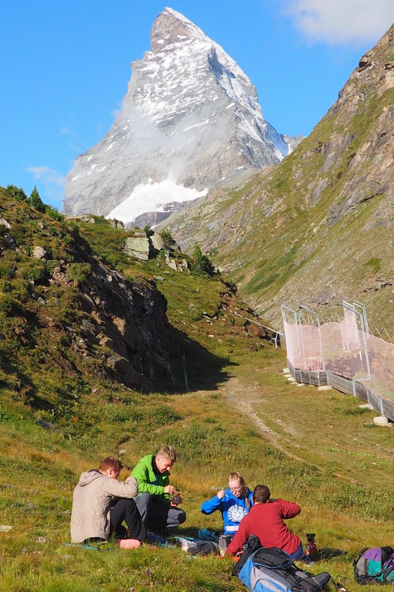
![Camping underneath the matterhorn [picture made by Emme Perreve]](http://hikersguidetoearth.eu/wp-content/uploads/matterhorn-camping.jpg)
The hike
We started and ended our three-day hike in Zermatt, the capital of the Matterhorn area. This village is really surreal, with people from different extremes. The outdoor fanatics have their scarpa mountaineering shoes, their arc’teryx outfit and alpinism rope and helmet strapped on their backpacks. Next to them there are the tourists, which are lazy af. They take the cable car up, walk a 100 meter such that they can take a picture and go to the nearest restaurant to have an all-inclusive buffet. They walk around with their trolleys and they buy from the cheap souvenir stores, of which zermatt is full off. Both these groups have too much money, and we didn’t really feel like being a part of this touristic town.
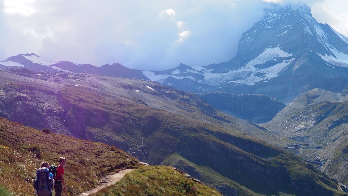
Immediately after leaving Zermatt behind, the roads got quiet, we didn’t see many people while making our way up. We camped somewhere with the view on the Matterhorn. When we got to the Theodulsee we had a great view of the Matterhorn and the lake. We took a small detour to hike up to the Matterhorn basecamp (Hörnlihütte), where we had a drink. Since going up and down to the basecamp is the same way, it was easy to leave the backpacks behind and just go without. On this altitude I really started to notice the lack of oxygen and therefore it was nice to hike without an extra weight pulling me down. On the last night we camped on a plateau with on one side a great view of the valley, and on the other side the Matterhorn.
The route
How to get there
It’s pretty easy to get to Matterhorn, the train to Zermatt leaves every hour. Just notice that the train to Zermatt is quite expensive, and that having a halbtax is probably gonna safe you some money. One way ticket to Zürich was around 60 CHF, and it takes around 3 h 15 to get there from Zürich HB. More information can be found on the website of the swiss train company.
Good to know
- Gronergrat – If you have time you cann add a detour to Hohtälli, Gornergrat and Riffelhorn, although high, i think would be well worth the effort.
- Matterhorn basecamp – Going to Hörnlihütte (Matterhorn basecamp, 3260 m) is also very much worth your time!
- For more information on hiking in switzerland make sure to check this page, and before getting out on your first hike read this article!
Best time to hike
![Clear eaxmple of the greenschist of the matterhorn area. [picture made by Emme Perreve]](http://hikersguidetoearth.eu/wp-content/uploads/greenschist-matterhorn.jpg)
Geology
Alpine orogeny
The Matterhorn has an amazing geological history, and it’s even cooler to do this three-day hike while knowing it. Around 200 million years ago, supercontinent Pangea (where the dinosaurs lived) broke apart by the Thetys ocean. The ocean separated two new continents called Laurasia (containing Europe and Asia) and Grondwana (containing Africa). After 100 million years the extension of the Thetys ocean stopped. A small continent, called the Apulian plate, broke off of Grondwana and started moving towards the european continent. This resulted into the western Thetys being subducted under the Apulian plate (with first the Piemont-Liguria Ocean and later the Valais ocean). The Alpine orogeny began at the end of the oceanic subduction. Then the European and Apulian continental crusts collided, which resulted in the formation of the nappes (sheets of rock).
Matterhorn lithology
So the Matterhorn consists of two parts: the Tsaté nappe and Dent Blance klippe (which is an erosional remnant of a nappe). The lithology of the lower Tsaté nappe is called greenschist. The nappe and klippe used to be part of the Piedmont-Liguria oceanic crust and consists of ophiolites and sedimentary rock. Ophiolites are leftovers of oceanic crust that were created at the mid-ocean ridge and later emplaced by tectonic forces at convergent plate boundaries. The forces that wielded at the subduction can be seen in the shape of the accretionairy prisms in the ophiolites.
The upper Dent Blanche nappe composes the pyramid of the matterhorn (above 3400 m), and consists of gneiss. Gneiss is a metamorphic rock, which means that it used to be another rock that has been deformed under high pressure or temparture. In the case of gneiss this parent rock is often either sandstone or granite. The Dent Blanche klippe is a remnant of the Apulian plate, which was the small continent that broke up from Africa before the alpine orogeny. So although the Matterhorn mostly consists of rocks found in Grondwana, nearby mountains like Monte Rosa consists of rocks which were part of Laurasia.
Shape of the Matterhorn explained
The characteristic pyramidal shape, which shapes the mountain today, is caused by natural erosion over the past million years. At the beginning of alpine orogeny, the Matterhorn was a rounded mountain like a hill. Because its height is above the snowline, its flanks are covered by ice, resulting from the accumulation and compaction of snow. During the warmer period of summer, part of the ice melts and seeps into the bedrock. When it freezes again, it fractures pieces of rock because of its dilatation (freeze-thaw). This forms a cirque, which is an amphitheatre-like valley formed by glacial erosion, and four cirques led to the shape of the mountain.
![The matterhorn under the fullmoon [picture made by Emme Perreve]](http://hikersguidetoearth.eu/wp-content/uploads/2021/08/matterhorn-view.jpg)
")

