
Hiking the Jura crest trail: an Alpine panoramic dream
In short
- What: Hiking and camping the Jura Crest Trail in Switzerland
-
Duration: 6-7 days
-
Distance: 120 km and 4210 height meters
-
Wildcamping: officially not allowed
-
Seasonality: April – October
-
Arrival with public transport: yes
- Highlights: Creux du Van, Mount Tendre en La Dôle.
Moving to Switzerland changed my life, in many different ways. I never really had a passion in the Netherlands, I just lived life like everyone else. Never really unhappy, but also lacking this feeling of regularly really being alive. I was just living my day-to-day life, doing the same things as the people around me. Two of my bachelor friends were talking about doing a masters in Applied Geophysics, for which you would study at three different universities. They would start in Delft, whereafter going to Zürich and Aachen. The idea appealed to me a lot, but alone I would never have had the courage to move around. I was too insecure and stable during this time of my life, but knowing my friends would be with me, made me decide to go for it.
Once arrived in Switzerland I ended up in a dormitory with 100 other exchange students. We all shared one common kitchen and living room, which was both a blessing and a curse. Since it was COVID, we were literally stuck together; most courses being online, all out-going facilities being closed. At this place I met my second family, my best friends in this world. We became such good friends because we share the same passions, but also because we just spend a lot of time together. Having hiked the Dutch Mountain Trail in the Netherlands, made me extremely excited to start hiking in Switzerland.
The first hiking opportunity arised during Easter. After asking around, I soon found other enthusiastic hikers among my roommates. Since the snow was still on low altitudes, the high Alps were out of question. We were left with either the Jura mountains or the southern part of Ticino (the italian speaking part of switzerland). We ended up going for the Jura Crest Trail, which is located on the northern and western side of the Alps. The Jura mountains consists mostly out of limestone ridges, and their elevation is not as high as the Alps.
![Having a break while watching the panoramic view of the alps [picture made by Emme Perreve]](http://hikersguidetoearth.eu/wp-content/uploads/2021/04/jura-crest-break.jpg)
Hiking the Jura Crest Trail
General
The Jura Crest trail is a Swiss national route starting close to Zürich, going all the way to Nyon (close to Geneva). The total trail counts 16 stages, each ranging between 13 and 25 km. Due to bad weather in the middle of the week, we hiked two times for three days, doing stage 10 to 16.
The trail (as the name suggests), basically goes over limestone crests the whole time. The crests have been altered by water, which means you normally ascend, hike along the crest, and descend after a few kilometers. Since the Jura is not that high, it’s not a great source of water, and doesn’t have many rivers or lakes. Luckily, this is solvable due to the many villages you pass through hiking the Jura Crest Trail. It does ask for a bit more organisation, you cannot simply sleep next to a river or a lake, with unlimited water.
In switzerland you can officially wildcamp in most cantons if you are above the treeline, arrive late in the evening and leave early in the morning. Since most of the trail is under the treeline, it is actually officially not allowed to wildcamp. However we never got any problems doing it, in most cases it felt more to me as if people were happy to see us camping. To see that young group of people from the city still take time to get out of the city, can still appreciate nature.
Everytime you reach the top of the crest on the trail, the most wonderfull panoramic view of the Alps appears right before your eyes. And watching the sunset lighten up the snowy alpine peaks with red, pink and purple colors is an unimagnable treat.
This hike was a very good first hike in switzerland, since it is also not as technical and extreme as the higher alpine areas. There was also still the comfort of going through towns everyday, not leaving society completely behind. The heigthmeters are not too much in total nor in one go, so your body can slowly create the muscles you need.
Creux du Van
We started our first three days of hiking the Jura Crest Trail in Noiraigue, a small swiss town in the canton of Neuchâtel. We arrived for the first time in the french speaking part of Switzerland, which was definitely noticeable in the culture difference. The weather was drowsy, but we were quickly heated up by the steep uphill.
I remember struggling quite a lot, since it was the first time I hiked in the mountains with a backpack (and european hiking roads are steep, my god). My backpack felt extremely heavy, because we brought a lot of fresh food. We had mushrooms for dinner and bananas to make chocholate bananas in the campfire (extremely yummie). But, struggling up the crest, i was cursing myself. The great thing about hiking though, is that you can just take a break whenever you want to, and go as slowly as needed. It felt like forever before we finally arrived on the ridge, seeing Creux du Van, a horseshoe shaped vertical cliff. Unfortunately, it was so misty that we didn’t see all of it.
We camped somewhere on a farmfield, where we made a campfire during the evening to battle the cold. The skies were clear, so one of our friends told us all about red dwarfs and which stars were visible.
![Hiking along the amazing panoramic view of the Alps [picture made by Emme Perreve]](http://hikersguidetoearth.eu/wp-content/uploads/2021/04/jura-crest-trail.jpg)
Le Chasseron & Cave Noire
The next morning we woke up with clear skies, but it was still cold. We crossed some shallow snowfields and hiked back up to the crest. Here we were amazed for the first time by the dazzling panoramic view over the Alps. We continued hiking with this view until Le Chasseron, where we took a long break in the sun. Afterwards we descended quickly to the town of Sainte-Croix, on a very steep road. We were surprised by its steepness and how technical it was, with lots of loose rocks, and how quickly the locals descended it. A bit after Sainte-Croix, where we could refill our water, we found a nice place next to a forest road to camp at. A local stopped to greet us, having no problem at all with us camping there.
The third morning of hiking the Jura Crest Trail the skies were still blue. We had a great lunch spot on a limestone outcrop overlooking the alps. Since most of us didn’t have hiking sticks, we gathered some nice wooden sticks to hike with. We visited Cave Noire, where we did some exploring and crawling around. Because the weather would be rainy the next days, we had decided to return home at the end of stage 12. We took the train back from Vallorbe and wanted to continue after a few days.
Mount Tendre
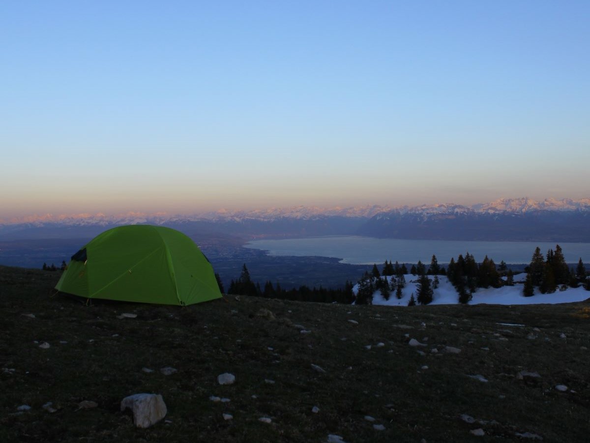
Returning after a few days in Vallorbe, we immideately had to ascend to the highest peak of the Swiss Jura. This was a tough one, not only because of the altitude difference, but also because of the snow. By the time we reached the end of the ascend, the snow got so soft that we would fall in knee-deep with every step we took. The last 200 height meters before reaching the crest, went extremely slow. Arriving on the peak gave us another beautiful view over the Swiss Alps, with Lake Geneva / Lac Léman and Lausanne on the foreground.
Walking a bit along the ridge, showed us an old abandoned wooden shelter for animals. Here we decided to camp and found some wood to make a campfire. Although extreme wind on the peak was a bit dangerous for the tents, the sunset and sunrise were so breathtaking, that it made us eager to sleep with such a view. I hung up a hammock in the shelter, and we all had a very cold and not so satisfying night of sleep. In the morning we got up early to watch the sunset and afterwards lightened the campfire again to get warm. However, in the end the only thing that made us really warm up again, was to start to hike.
La Dôle
The day passed without much excitement happening. It was mostly cold and cloudy and we hiked through a lot of snowy fields and forests, with some occasional lounging in the sun as well. We camped on the edge of such a forest where we build up a campfire again. After a better night of sleep only me and one of my friends wanted to continue the rest of the hike. The others took the train from Saint-Cergue to enjoy a beer at the lake in the sun. Me and my friend continued hiking to La Dôle, the second highest peak of the swiss Jura.
The hike to La Dôle was very snowy, windy and cloudy. Once arrived on the peak, we couldn’t even have lunch there because of the cutting wind. We quickly descended again, lost our way and decided to have lunch before getting completely lost. After a few hours we arrived in Gingins in a very weary state. In vain hoping that we could still catch our friends at the lake, too much time had passed and we headed back to Zürich.
The route
Next to the komoot route, more information about the trail can be found on SchweizMobil.
How to get there
For the first three-day hike we started in Noiraigue and ended in Vallorbe, which are respectively 2 hours and 2h45 away by train from Zürich HB. The second three-day hike started in Vallorbe and we ended at the busstop Ouest in Gingins, which is located a bit more than 3h away from Zürich. Vallorbe is located close to Le Pont, at the end of the 13th stage of the trail, after 53 km of the total 119 km. Most of the start and end of the stages are easily reacheable by swiss public transport.
Good to know
- One amazing thing about the Jura Crest Trail is that you’re mostly hiking under the treeline, and can find wood to make campfires almost everywhere. Especially when doing this trail in the early spring/autumn, where days are short and nights are cold, this is a great way to spend the evenings.
- There’s not too many fresh water sources outside of the small villages you pass through. Luckily you pass a village everyday, but when sleeping on top of the crest, you need to bring a bit more water than normally. If there’s still snow, you can ofcourse melt the snow. This process does take a long time, and old snow can be very dirty, and it lacks minerals.
- The part we hiked of the trail (from Noiraigue to Nyon), is in the french speaking area of switzerland.
- For more information on hiking in switzerland make sure to check this page, and before getting out on your first hike read this article.
Best time to hike
Although we were maybe a bit too early in the year – there was still quite some snow in the higher laying areas, it is a good multi-day hike to do in the beginning of the season. It is way more accessible than the Alps during spring and autumn.
![Camping on Mount Tendre, while looking out over Lac Léman / Lake Geneva. [picture made by Felix Wursthorn]](http://hikersguidetoearth.eu/wp-content/uploads/2021/04/campfire-mount-tendre.jpg)
Geology
During the Jurassic period (140 – 200 Ma), when the dinosaurs lived, most of Switzerland was covered by the Thetys ocean. This was the ocean which divided the continents Laurasia and Grondwana, which formerly constituted the supercontinent Pangea. When the Thetys ocean subducted and the continents collided, the continental plates caused the rise of the Alps. The sedimentary rocks of the Jura were compressed and folded due to this Alpine orogeny. It consists of a sequence of geologic folds which are built up vertically while decreasing in size laterally, further away from the younger, more active Alpine mountain building. The geological folds show environments from three different epochs in the Jura. Each era of folding shows previously shallow marine enviroments (carbonate/fish bones), containing bioclasts and oolitic as well.
")

